← All modules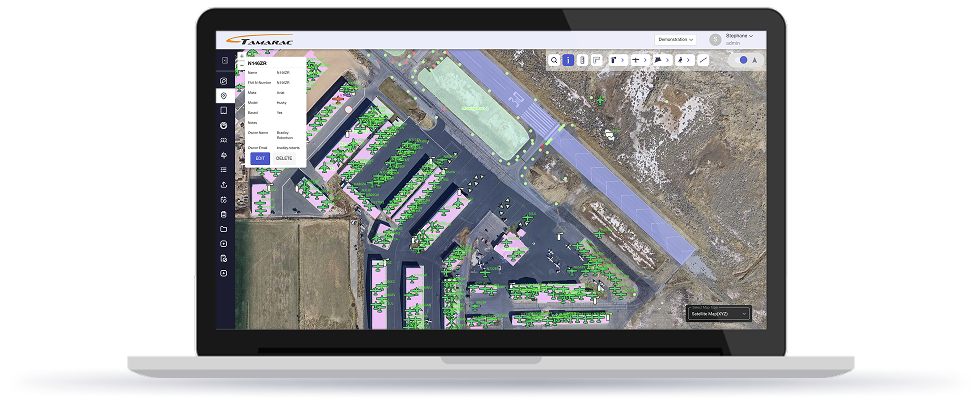
MOD_01 · CORE
GIS & Airport Digital Twin
An interactive map that thinks like your airfield.
Layered GIS surface that links every hangar, aircraft, tie-down, light, and pavement section to live operational data — the spatial backbone of every other Tamarac module.
Walkthrough
See GIS & Airport Digital Twin in motion.
Video placeholder
Walkthrough video for GIS & Airport Digital Twin coming soon. Drop a YouTube ID into
videoId insrc/lib/modules.ts to embed it here.Capabilities
What it does, end to end.
- Interactive airport map with layered objects
- Hangars, aircraft, tie-downs, lights, pavement
- Polygon tools for zones & boundaries
- KMZ & DWG engineering file imports
- Distance & area measurement tools
- Google Earth & FAA data exports
- RPZ, noise abatement & snow zone overlays
How it fits
Connected to the rest of your airfield.
GIS & Airport Digital Twin shares the same spatial database, directory, and audit trail as every other Tamarac module. Changes here propagate everywhere they should — and nowhere they shouldn't.
Built in
Spatial linkage
Built in
Audit trail
Built in
Role-based access
Ready when you are
See Tamarac running on an airfield like yours.
A 30-minute working session with an operator who's done your job. No slide decks.